
Ottoman Provincial Governance and Mamluk Factionalism 1700, 1798
| Year | Event / Condition | Estimated Population | Notes |
|---|---|---|---|
| 1700 | Ottoman Provincial Stability | 230, 000 | Recovery from 17th-century stagnation. |
| 1781 | Plague Outbreak | 240, 000 | High mortality among Mamluk ranks. |
| 1791 | Great Plague | 180, 000 | Severe depopulation; economic paralysis. |
| 1798 | Pre-French Invasion | 260, 000 | Rapid recovery due to rural migration. |
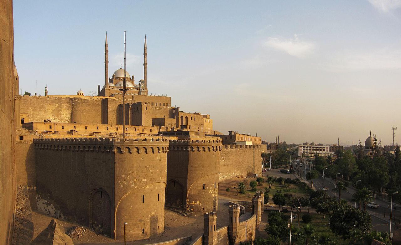
Commercial life in Cairo during this period relied heavily on the coffee trade. Yemeni coffee, imported through the Red Sea port of Suez and distributed from the Wikala of Dhu'l-Fiqar, generated immense wealth for the ruling beys. They levied heavy customs duties on this trade, as well as on spices and textiles from India. French merchants, who had established a presence in the city, grew increasingly vocal about the arbitrary taxes and seizures imposed by Murad Bey. These grievances would later provide a pretext for Napoleon's invasion. The beys, insulated in their palaces and consumed by petty rivalries, remained oblivious to the shifting geopolitical in Europe. They viewed the French merchants as sources of revenue, failing to recognize them as the vanguard of a new imperial threat. The intellectual life of Cairo, centered on Al-Azhar University, remained vibrant even with the political chaos. Scholars like Al-Jabarti recorded the events of the time with meticulous detail, providing a counter-narrative to the self-aggrandizing chronicles of the Mamluks. Al-Jabarti's writings reveal a society deeply skeptical of its rulers. The populace viewed the Mamluks not as legitimate sovereigns as foreign oppressors who had usurped the Sultan's authority. When the Mamluks rode through the streets, they did so surrounded by armed guards, a testament to the hostility of the Cairene street. By 1798, the Ottoman presence in Cairo had been reduced to a legal fiction. The Pasha was a prisoner in the Citadel, while Murad Bey and Ibrahim Bey divided the revenues of the country between them. The *iltizam* system had stripped the countryside bare, driving peasants into the city where they swelled the ranks of the urban poor. The Mamluk military, once a formidable force, had stagnated technologically, relying on medieval cavalry charges while European armies mastered artillery and disciplined infantry. This technological and administrative obsolescence set the stage for the shock of the French invasion. The Mamluks believed their own myth of invincibility, unaware that the world had changed around them. They prepared to meet modern cannons with swords, convinced that courage alone would secure their rule. The city they governed was a powder keg of social resentment, economic exhaustion, and political illegitimacy, waiting for a spark.
French Occupation and the Rise of Muhammad Ali Pasha 1798, 1848
| Year | Event | Impact on Cairo |
|---|---|---|
| 1798 | French Occupation & Revolt of Cairo | Al-Azhar bombarded; city divided into 8 administrative districts. |
| 1811 | Citadel Massacre | Elimination of Mamluk elite; consolidation of Muhammad Ali's power. |
| 1820 | Bulaq Press Established | Start of mass printing; Bulaq becomes an industrial zone. |
| 1830 | Construction of Alabaster Mosque | Citadel skyline altered; Mamluk palaces demolished. |
| 1831 | Cholera Epidemic | Thousands dead; exposes failure of early sanitary reforms. |
| 1848 | Modern Census | Cairo population recorded at ~256, 000; state surveillance increases. |
Khedival Urban Planning and Sovereign Debt Crisis 1863, 1882
Khedive Ismail assumed the throne in 1863 with a declaration that would define the two decades of Egyptian history: "My country is no longer in Africa; we are part of Europe." This was not a rhetorical flourish a statement of intent that initiated a period of aggressive modernization, financed by a volatile combination of cotton revenues and predatory European lending. Ismail aimed to remodel Cairo into a "Paris on the Nile," a project that physically bifurcated the city and mortgaged the nation's sovereignty to foreign creditors.
The economic engine for this transformation was the American Civil War (1861, 1865). As the Union blockade choked off cotton supplies from the American South, British textile mills turned to Egypt. The price of Egyptian cotton skyrocketed, quadrupling in value between 1861 and 1864. This "white gold" poured capital into the Egyptian treasury, encouraging Ismail to embark on infrastructure projects of a previously unimagined. The state revenue jumped from roughly £4 million to over £13 million during the war years, creating a dangerous illusion of perpetual solvency.
Ismail entrusted the physical restructuring of Cairo to Ali Mubarak, his Minister of Public Works and a Paris-educated engineer. Mubarak's mandate was to create a new city alongside the old, rather than rehabilitating the medieval core. The result was the Ismailiya quarter, a district characterized by wide, geometric boulevards, gas lighting, and European-style architecture. This new zone stood in clear contrast to the winding, organic street patterns of the historic city. The Qasr al-Nil, completed in 1871, physically linked this new district to the western bank of the Nile, cementing the westward expansion of the capital. By 1872, the city had two distinct faces: the European quarter for the elite and foreigners, and the "native" quarter where the majority of Cairenes lived in deteriorating conditions.
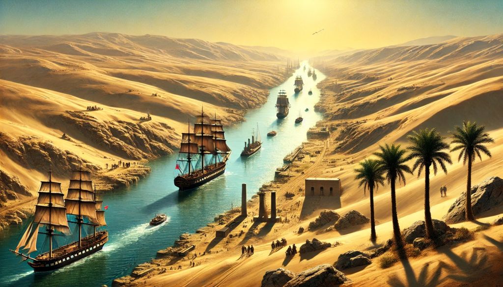
The apex of this modernization drive was the opening of the Suez Canal in November 1869. To host the visiting European royalty, including Empress Eugénie of France, Ismail ordered the construction of the Cairo Opera House, which was completed in a frantic five months at a cost of £60, 000. The festivities themselves were legendary in their excess, with reports estimating the total cost of the celebrations and associated infrastructure upgrades at over £2 million. This event was intended to showcase Egypt as a civilized, modern power, yet it occurred just as the economic was turning.
The end of the American Civil War brought a crash in cotton prices, yet Ismail's spending did not contract. To maintain the pace of development, the Khedive turned to European financial markets. The banking houses of London and Paris, including Oppenheim and Rothschild, facilitated a series of loans with increasingly usurious terms. The method of these loans were designed to entrap the borrower. For instance, a loan might be issued with a face value of £32 million, after discounts and commissions, the Egyptian treasury would receive less than £20 million, while remaining liable for the full principal plus interest. Real interest rates frequently exceeded 20 percent.
| Year | Approximate Foreign Debt (£ Sterling) | Primary Economic Driver/Event |
|---|---|---|
| 1863 | 3, 000, 000 | Accession of Ismail; Cotton Boom begins |
| 1868 | 15, 000, 000 | Post-Civil War Cotton Crash; Infrastructure spending |
| 1873 | 45, 000, 000 | Oppenheim Loan; Peak borrowing |
| 1876 | 94, 000, 000 | State Bankruptcy; Caisse de la Dette established |
By 1875, the financial situation had become desperate. In a last-ditch effort to service the debt, Ismail sold Egypt's 44 percent share in the Suez Canal Company to the British government for £4 million. The relief was temporary. The money was immediately absorbed by creditors, leaving Egypt with neither the shares nor the capital. In 1876, Ismail was forced to suspend payment on treasury bills, declaring state bankruptcy. The total foreign debt had ballooned from £3 million at his accession to approximately £94 million.
The consequences of this default were immediate and severe. European powers established the Caisse de la Dette Publique (Commission of the Public Debt) to manage Egypt's finances. This body, staffed by European controllers, prioritized debt service over internal development or public welfare. In 1877, more than 60 percent of Egypt's total revenue was diverted to pay foreign bondholders. To meet these demands, the tax load on the Egyptian peasantry (fellahin) was increased ruthlessly. The Muqabala law, which allowed landholders to pay six years of taxes in advance in exchange for future relief, was one of desperate schemes to raise cash that failed to the bleeding.
This financial colonization sparked intense domestic unrest. The "Dual Control" system, where a British official oversaw revenue and a French official oversaw expenditure, stripped the Khedive of his sovereignty. When Ismail attempted to assert independence in 1879 by dismissing the European ministers, the European powers pressured the Ottoman Sultan to depose him. Ismail was sent into exile, and his son Tewfik was installed as a puppet ruler, tasked with enforcing the austerity measures dictated by the creditors.
The of sovereignty and the economic hardship faced by the army and the peasantry coalesced into the Urabi Revolt (1879, 1882). Led by Colonel Ahmed Urabi, a native Egyptian officer, the movement demanded a constitution, parliamentary oversight of the budget, and a halt to foreign interference. The slogan "Egypt for the Egyptians" resonated across the social spectrum, from the disgruntled military to the overtaxed rural population. By 1881, Urabi had cornered Khedive Tewfik, forcing the appointment of a nationalist cabinet.
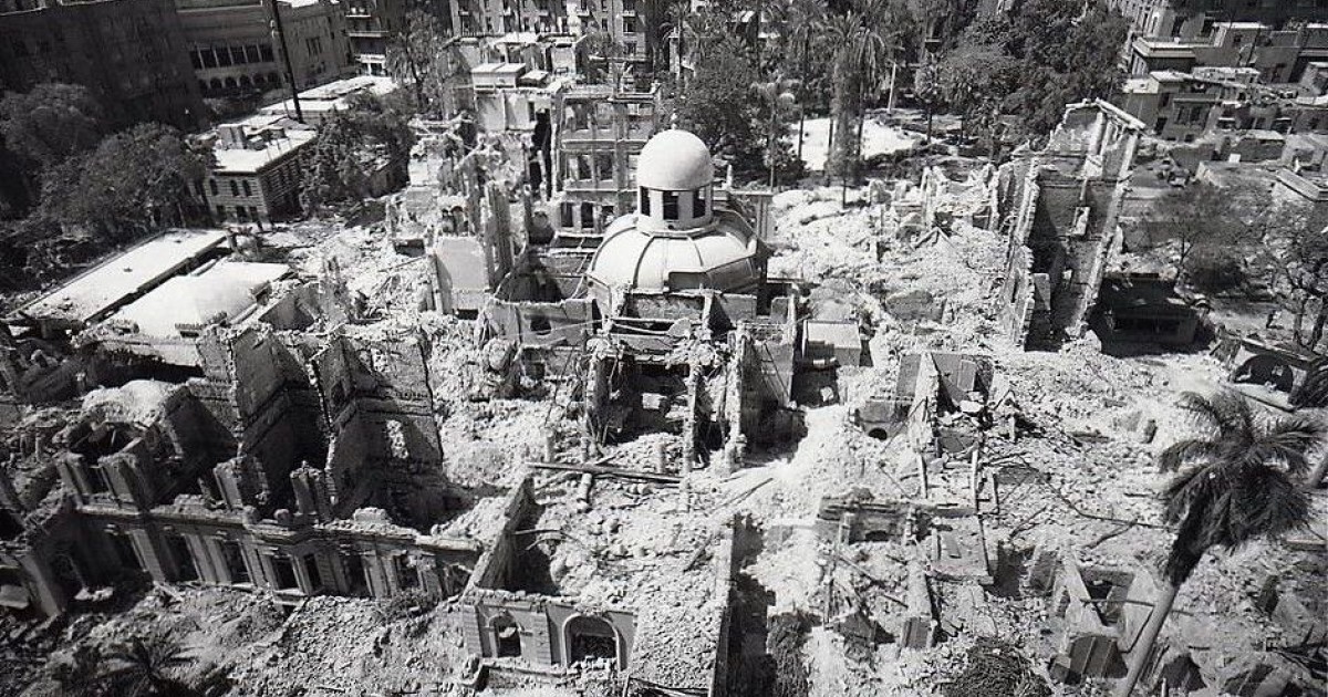
The prospect of a nationalist government repudiating the debt or seizing the Suez Canal was unacceptable to Britain and France. In the summer of 1882, anti-European riots in Alexandria provided the pretext for intervention. The British Royal Navy bombarded Alexandria in July, reducing large sections of the city to rubble. This was followed by a full- invasion. British forces defeated Urabi's army at the Battle of Tel el-Kebir in September 1882. Two days later, British troops entered Cairo, marking the beginning of a "temporary" occupation that would last until 1956. The dream of a sovereign, European-style Cairo had ended in military conquest, leaving behind a city divided by class and architecture, and a nation shackled by the very debt incurred to modernize it.
British Colonial Administration and Cairene Nationalist Movements 1882, 1952
| Year | Event / Metric | Details |
|---|---|---|
| 1882 | British Occupation Begins | Population: ~374, 000. Cromer establishes "Veiled Protectorate." |
| 1906 | Dinshaway Incident Reaction | Mass protests in Cairo radicalize the urban effendiyya class. |
| 1919 | 1919 Revolution | 800+ killed. Tram lines cut. Women's demonstrations in Ismailiya district. |
| 1942 | Abdeen Palace Incident | British tanks surround King Farouk's palace to force Wafd government. |
| 1947 | Census Population | Population reaches ~2. 09 million. High density in "native" quarters. |
| 1952 | Black Saturday (Cairo Fire) | ~750 buildings destroyed. Shepheard's Hotel burned. 26+ deaths. |
The interwar period, frequently termed Egypt's "Liberal Age," proved to be a facade of parliamentary democracy masking a three-way power struggle between the Wafd Party, the Palace, and the British Residency. Cairo served as the stage for this dysfunction. The 1923 Constitution theoretically the electorate, yet the King frequently dissolved parliament, and the British High Commissioner retained the final word on security. This political impotence reached its nadir on February 4, 1942. With Rommel's Afrika Korps advancing, the British Ambassador Sir Miles Lampson ordered tanks to surround Abdeen Palace. He presented King Farouk with an ultimatum: appoint a pro-British Wafd government or abdicate. Farouk capitulated. While this secured the Allied rear during World War II, it destroyed the legitimacy of both the monarchy and the Wafd in the eyes of the Cairene public. In the vacuum left by the discredited elite, radical extra-parliamentary groups seized the street. The Muslim Brotherhood, founded in 1928, established a formidable network of branches across Cairo, providing social services, clinics, and schools where the state had failed. Their paramilitary wing, the Secret Apparatus, engaged in a campaign of assassinations against judges and ministers. Simultaneously, communist cells and the Young Egypt (Green Shirts) movement organized strikes and student riots. By the late 1940s, Cairo was a city on edge, plagued by inflation, unemployment, and the humiliating presence of British troops who refused to evacuate the Suez Canal zone. The tension broke on January 26, 1952, a day etched in history as "Black Saturday." Following a massacre of Egyptian auxiliary police by British forces in Ismailia the previous day, crowds gathered in downtown Cairo. What began as a police protest mutated into a systematic burning of the symbols of European presence and aristocratic privilege. The mob targeted the turf of the colonial elite: the Turf Club, the Rivoli Cinema, the Automobile Club, and the iconic Shepheard's Hotel. Witnesses described organized groups using petrol to torch specific buildings while looting others. The fire raged for hours as the King hesitated to deploy the army. By sunset, the heart of modern Cairo, the "Paris on the Nile" built by Khedive Ismail, lay in ashes. Approximately 750 buildings were destroyed or damaged. The Cairo Fire was not a riot; it was the funeral pyre of the old regime. The smoke that billowed over the Nile signaled that the liberal experiment was over. Six months later, the Free Officers Movement, led by Gamal Abdel Nasser, executed a coup that swept away the monarchy, the pashas, and the British occupation, opening a new chapter in the city's millennia-long history.
Post-1952 Revolution Industrialization and Socialist Architecture
The 1952 Free Officers coup did not depose a monarch; it initiated a systematic spatial reordering of Cairo intended to erase the Khedivial "Paris on the Nile." Gamal Abdel Nasser and his Revolutionary Command Council viewed the European-style downtown and the garden suburbs of Maadi and Heliopolis as architectural manifestations of colonial subservience. To project the power of the new republic, the state turned to two primary method: heavy industrialization and the construction of massive, state-planned urban districts. This era replaced the ornate Italianate plaster of the fin de siècle with the unadorned concrete of socialist brutalism, fundamentally altering the city's metabolism from a commercial hub to an industrial production center.
The crown jewel of this transformation was Helwan. Once a therapeutic retreat for the pasha class known for its sulfur springs and winter palaces, Helwan was repurposed by decree in 1954 to become the "industrial " of the revolution. The regime established the Egyptian Iron and Steel Company (Hadisolb) in 1955, with production commencing in 1958. While West German firm Demag provided initial technology, the Soviet Union later supplied the technical and financial backing necessary to expand operations, cementing the facility as a symbol of non-aligned self-sufficiency. By the mid-1960s, Helwan housed not only the steelworks also factories for cement, textiles, and automobiles (El Nasr Automotive Manufacturing Company). This industrial zoning decision had catastrophic long-term environmental consequences, trapping toxic emissions against the Mokattam hills and permanently altering the air quality of the southern capital.
The economic logic of the Nasserist state demanded a new urban form to house the burgeoning technocratic class and the military elite. In 1956, the architect Sayed Karim presented the master plan for Nasr City (Medinet Nasr), a massive eastward expansion into the desert. Unlike the organic growth of Old Cairo or the radial planning of downtown, Nasr City employed a rigid orthogonal grid, characterized by wide boulevards designed to accommodate military parades and rapid vehicular movement. The district was intended to serve as a new administrative capital, shifting the center of away from Tahrir Square. Government ministries, the Central Agency for Public Mobilization and Statistics (CAPMAS), and the Al-Azhar University campus were relocated here. Karim's original vision included the concept of the "socialist villa", modest, detached homes for the middle class, yet economic realities forced a shift toward high-density apartment blocks.
State-led construction introduced a new architectural typology: the masakin (popular housing). Between 1952 and 1965, the government constructed approximately 15, 000 public housing units. While statistically insignificant compared to the population boom, these projects, such as the Workers' City in Imbaba and the Zeinhom blocks, established the state as the primary provider of shelter. These structures prioritized function over form, stripping away the courtyards and ornamentation that defined Cairene domestic architecture for centuries. The buildings were standardized, repetitive concrete slabs, frequently arranged in parallel rows that ignored local wind patterns and solar orientation. This uniformity was ideological; it signaled a commitment to egalitarianism, even if the quality of construction frequently rapidly.
The Maspero Television Building, completed in 1960 on the banks of the Nile, stands as the most potent architectural symbol of this era. Designed by Naoum Shebib, the massive curved structure housed the state media apparatus, the voice of Pan-Arabism. Its construction required the demolition of existing riverfront properties, physically asserting the regime's dominance over the prime real estate of the capital. Maspero was not just an office building; it was a of information, guarded by tanks during times of unrest, and remained the nerve center of the Egyptian state's narrative control until the media fractured in the 21st century.
Industrialization triggered a demographic explosion that overwhelmed the state's planning capacities. The pledge of factory jobs in Helwan and Shubra el-Kheima drew millions from the Delta and Upper Egypt. The state's inability to build housing at the pace of migration led to the densification of existing districts and the birth of the ashwa'iyyat (informal settlements). By 1966, Cairo's population had surged to over 4. 2 million, up from 2 million in 1947. The table demonstrates the correlation between the industrial push and population growth during the serious years of the socialist experiment.
| Year | Cairo Population | Key Industrial/Political Context |
|---|---|---|
| 1947 | 2. 09 Million | Pre-Revolution; End of British military presence in city |
| 1960 | 3. 35 Million | Five-Year Industrial Plan launched; Maspero opens |
| 1966 | 4. 22 Million | Peak of Nasserist industrial employment; High Dam construction |
| 1976 | 6. 10 Million | Post-1973 War; Beginning of Infitah (Open Door) policy |
The legacy of this era faced a definitive reckoning in the 2020s. The Egyptian Iron and Steel Company in Helwan, once the pride of the revolution, suffered from decades of neglect, technological obsolescence, and accumulated debts exceeding 8. 5 billion EGP. In January 2021, the General Assembly of the company decided to liquidate the factory, marking the official death of the Nasserist industrial dream. The sprawling complex, which once employed 25, 000 workers, had been operating at less than 11% capacity. Its closure signaled the state's pivot away from the import-substitution industrialization model toward a new economic paradigm focused on real estate speculation and logistics.
Nasr City, too, has mutated far beyond Sayed Karim's master plan. By 2026, the district had become a zone of extreme density, its "socialist villas" demolished to make way for high-rise towers. The wide boulevards, originally meant for fluid movement, became choked arteries of traffic, prompting the construction of a massive network of flyovers and the East Cairo Monorail in the early 2020s. These concrete ribbons slice through the neighborhood, casting shadows over the mid-century blocks. The Maspero Triangle, the slum area that grew in the shadow of the television building, was razed in 2018 to make way for luxury high-rises, completing the pattern of erasure. The socialist city, built to the worker and the bureaucrat, has been systematically dismantled and redeveloped to serve the flow of global capital.
Informal Settlement Expansion and Ashwa'iyyat Demographics 1974, 2011
| Metric | Informal Areas (e. g., Dar el-Salam) | New Desert Cities (e. g., New Cairo) |
|---|---|---|
| Population Density (2006) | ~77, 000 inhabitants/km² | < 500 inhabitants/km² |
| Housing Production Share (1990s) | ~80% of total units | ~15% (mostly vacant) |
| Legal Status | Unregistered / Wad' al-yad | State-sanctioned / Registered |
| Infrastructure Access | Informal tapping / Retroactive | Pre-planned / Oversized |
Throughout the 1990s and 2000s, the Mubarak regime attempted to divert population growth to the desert through the New Towns program (e. g., 6th of October City, New Cairo). This strategy failed catastrophically in demographic terms. The desert cities remained ghost towns for years, accessible only to the wealthy who owned cars, while the poor continued to densify the valley. The passing of Law 4 of 1996, which liberalized rents for new contracts, further squeezed the lower-middle class, pushing more families into the informal market where ownership, yet legally precarious, offered security against eviction. By 2008, estimates suggested that over 60 percent of Greater Cairo's population resided in informal areas. The distinction between "unplanned" (agricultural land encroachments) and "unsafe" (slums on hazardous terrain) became lethally clear on September 6, 2008. In the Manshiyat Naser district, massive limestone boulders broke loose from the Muqattam plateau, crushing the shantytown of Duweiqa. Official figures 119 deaths, though residents and local NGOs insisted the toll was far higher, with bodies remaining buried under thousands of tons of rock. The Duweiqa rockslide forced the state to acknowledge the physical danger of its neglect. In response, the government established the Informal Settlements Development Fund (ISDF) to map and eradicate "unsafe areas," marking a shift from ignoring these zones to actively targeting them for demolition and redevelopment. By 2011, the demographic weight of the *ashwa'iyyat* had tipped the political. These areas, long marginalized and subjected to police harassment rather than municipal service, became reservoirs of deep anti-regime resentment. The social contract had been broken for decades; the state provided neither security nor housing, only corruption and repression. When the uprising began in January, the mobilization power of these densely packed, aggrieved communities proved decisive in overwhelming the security apparatus that had once besieged them.
Tahrir Square Political Mobilization and Security Crackdowns 2011, 2013
| Event | Date | Location | Key Details | Estimated Deaths |
|---|---|---|---|---|
| Battle of the Camel | Feb 2, 2011 | Tahrir Square | Pro-regime thugs on horses/camels charge sit-in. | 11 (in specific attack) |
| Maspero Massacre | Oct 9, 2011 | Maspero TV Building | Military APCs crush Coptic protesters. | 28 |
| Mohamed Mahmoud | Nov 19, 24, 2011 | Downtown Cairo | Police snipers target eyes; heavy tear gas use. | 40+ |
| Cabinet Clashes | Dec 16, 20, 2011 | Qasr al-Aini Street | Burning of Institut d'Égypte. | 17 |
| Itihadiya Clashes | Dec 5, 2012 | Heliopolis | Brotherhood cadres attack opposition sit-in. | 11 |
Nile Hydrology, Water Scarcity, and Sanitation Infrastructure
| Metric | 1800 (Ottoman) | 1907 (British) | 1985 (Mubarak) | 2026 (Sisi) |
|---|---|---|---|---|
| Population | ~260, 000 | 654, 000 | ~8 Million | ~22 Million |
| Water Source | Nile & Wells | Reticulated Network (Partial) | Aswan High Dam Regulated | Nile, Desalination, Reuse |
| Per Capita Water | Variable (Flood dependent) | ~1, 000+ m³ (Est.) | ~900 m³ | ~490 m³ |
| Sanitation Method | Cesspits / Canal dumping | Bucket removal / Early sewers | Overloaded sewers / Flooding | Treatment Plants / Leakage |
The in infrastructure investment defines the current hydro-political reality. While the New Administrative Capital receives a dedicated supply line with a capacity of 1. 5 million cubic meters per day, Old Cairo struggles with an aging network that loses nearly 30 percent of its potable water to leakage. Residents in informal areas frequently rely on public taps or expensive private trucking, creating a clear hydraulic apartheid. The government's 2026 strategy relies heavily on desalination and wastewater recycling to plug the gap, yet the fundamental arithmetic remains unforgiving: the population grows, the Nile shrinks, and the pipes beneath the old city continue to rust.
Air Quality Metrics and the Black Cloud Phenomenon
For centuries, the air of Cairo has carried the weight of its geography. Since the eighteenth century, and likely long before, the city has endured the Khamasin, a fifty-day spring wind that scours the Western Desert and deposits tons of particulate matter onto the Nile Delta. French soldiers under Napoleon Bonaparte in 1798 recorded these suffocating dust storms, noting how the sky turned a blood-red tint before visibility entirely. This natural baseline of coarse dust (PM10) defined the respiratory load of the city for generations, a seasonal affliction accepted as the price of living on the desert's edge.
The mid-twentieth century introduced a more toxic, permanent to this atmosphere. The industrialization drive of the 1950s, specifically the establishment of heavy cement and steel industries in Helwan to the south and Shubra El-Kheima to the north, encircled the city in a ring of smokestacks. By the 1970s, Helwan's cement factories were belching thousands of tons of cement kiln dust annually. This gray smog, rich in heavy metals and sulfur dioxide, settled over the valley, trapped by the Muqattam Hills. The pollution was constant, yet it absence the acute, suffocating density that would later define Cairo's autumns.
That changed in the fall of 1999. Residents woke to a dark, heavy fog that did not lift with the morning sun. It burned the eyes and tasted of charred wood. This was the birth of the "Black Cloud" (al-Sahaba al-Sawda), a phenomenon that has plagued the capital every October and November for over two decades. The cloud was not a single source event a convergence of agricultural malpractice and meteorology. In the Nile Delta, farmers harvested rice and, absence to process the massive volume of silica-rich straw, burned it in open fields. Simultaneously, a thermal inversion , a meteorological lid of warm air sitting atop cold air, trapped this smoke close to the ground, preventing its dispersion into the upper atmosphere.
The metrics of this pollution reveal a public health disaster. During Black Cloud episodes, concentrations of PM2. 5, fine particulate matter capable of penetrating the bloodstream, frequently spike to levels exceeding 300 micrograms per cubic meter, more than twenty times the World Health Organization's safe limit of 15 micrograms. A World Bank report analyzing data from 2017 estimated that air pollution in Greater Cairo resulted in approximately 19, 000 premature deaths annually. The economic cost is equally severe, eroding between 1. 4 percent and 2. 5 percent of Egypt's GDP through healthcare expenditures and lost productivity.
| Period | Event / Metric | Primary Driver |
|---|---|---|
| Fall 1999 | recorded "Black Cloud" | Rice straw burning + Thermal Inversion |
| 2000, 2010 | PM10 exceeds 150 µg/m³ annual avg | Vehicle emissions, Helwan Cement, Open burning |
| 2017 | 19, 000 estimated premature deaths | PM2. 5 exposure (World Bank Data) |
| 2020 | $200 Million World Bank Project | Pollution abatement & waste management |
| 2023, 2025 | Rice straw recycling rate hits ~90% | Govt collection for fertilizer/cement fuel |
| 2026 (Proj) | Daily PM2. 5 avg: 35, 60 µg/m³ | Traffic & Construction dust (New Capital works) |
Government intervention has evolved from denial to active management. Early attempts in the 2000s to criminalize straw burning failed due to the absence of viable alternatives for farmers. By 2020, a shift in strategy monetized the waste. The Ministry of Environment, in partnership with private contractors, established collection sites where farmers could sell straw. This material is pressed and sold to cement factories, ironically, the old polluters of Helwan, to be used as biofuel. Reports from 2024 and 2025 indicate that over 90 percent of the rice straw generated in the Delta is collected rather than burned, significantly reducing the agricultural component of the cloud.
Even with these agricultural successes, the air remains hazardous. The reduction in smoke from the Delta exposed the chronic severity of Cairo's internal pollution sources: an aging fleet of diesel buses, millions of private vehicles, and the dust generated by the construction of the New Administrative Capital. Between 2019 and 2024, the expansion of road networks to connect Old Cairo to the new capital led to the removal of thousands of mature trees in districts like Heliopolis and Maadi. This loss of green lung capacity has removed a serious filter for suspended dust, causing local temperatures to rise and particulate matter to linger longer at street level.
As of early 2026, the Black Cloud has transformed from an acute seasonal emergency into a managed chronic condition. The thick, visibility-killing smoke of 1999 is rarer, replaced by a persistent gray haze of traffic exhaust and construction dust. Real-time air quality indices in March 2026 frequently show "Moderate" to "Unhealthy for Sensitive Groups" readings, rarely dipping into the "Good" category. The thermal inversion remains a fixed meteorological reality, meaning that any failure in emission controls, whether from a factory in Helwan or a smoldering landfill in Qalyubia, immediately manifests as a suffocating blanket over the city.
Traffic Congestion Economic Costs and Metro Network Analysis
The urban paralysis of Cairo is not a modern inconvenience the mathematical inevitability of a city designed for nineteenth-century carriages attempting to accommodate twenty- -century vehicular density. The roots of this gridlock lie in the 1860s, when Khedive Ismail commissioned a "Paris on the Nile," carving wide boulevards through the scrubland west of the medieval core. This Ismaili district, intended to showcase modernity, absence the foresight for the internal combustion engine. By 2026, these once-spacious avenues, along with the narrow, winding alleys of the Fatimid city, form a sclerotic network where traffic moves at an average speed of less than 15 kilometers per hour during peak windows.
The economic caused by this congestion is severe. A benchmark study by the World Bank in 2014 estimated the annual cost of Cairo's traffic at $8 billion, roughly 3. 6 percent of Egypt's GDP at the time. By 2025, adjusted for inflation and population growth, independent economic assessments place this loss significantly higher. The costs manifest in wasted fuel, vehicular wear, and, most serious, lost man-hours. The average Cairene commuter spends nearly two hours daily in transit, a productivity drain that stifles the city's economic output. The absence of enforced lane discipline and the prevalence of informal microbuses, which stop abruptly to collect passengers, worsen the flow, creating a chaotic environment where right-of-way is determined by aggression rather than law.
To combat this, the state has relied heavily on the National Authority for Tunnels (NAT) to expand the Cairo Metro, the system of its kind in Africa. Line 1, operational since 1987, serves as the spine of the network, connecting Helwan in the south to El Marg in the north. It carries the heaviest passenger load, frequently exceeding 1. 5 million riders daily. Line 2, completed in the late 1990s, introduced the tunnel under the Nile, linking Giza to Shoubra. Yet, for decades, these two lines were insufficient for a metropolitan area exceeding 20 million residents.
The acceleration of infrastructure development between 2014 and 2026 marked a shift in strategy. Line 3, known as the "Green Line," reached full operational status by 2024, connecting central Cairo to the Ring Road and the Adly Mansour interchange. This line serves as a transversal artery, crossing under the Nile twice and integrating with the new electric transport network. Construction on Line 4, heavily funded by the Japan International Cooperation Agency (JICA), remains active in 2026. Known as the "Tourism Line," it eventually connect the Grand Egyptian Museum and the Pyramids of Giza to the city center, though its completion faces delays due to the complexity of tunneling through archaeologically sensitive strata.
| Line / System | Primary Route | Status (2026) | Key Funding/Contractors |
|---|---|---|---|
| Metro Line 1 | Helwan , El Marg | Operational (Upgrading Rolling Stock) | Alstom (France) / State Funded |
| Metro Line 2 | Shoubra , El Mounib | Operational | State Funded |
| Metro Line 3 | Imbaba , Cairo Univ. , Adly Mansour | Fully Operational | RATP Dev (Operator), EIB, AFD |
| Metro Line 4 | Giza Pyramids , New Cairo | Phase 1 Under Construction | JICA (Japan), Orascom, Mitsubishi |
| Monorail East | Nasr City , New Admin Capital | Passenger Service (Jan 2026) | Alstom, Orascom, Arab Contractors |
| LRT (Light Rail) | Adly Mansour , New Admin Capital | Operational | China (AVIC), Egyptian State |
The most visible addition to the skyline is the Cairo Monorail. The East Nile line, connecting the stadium area in Nasr City to the New Administrative Capital, commenced passenger operations in January 2026 after months of trial runs. This driverless system, elevated above the congested streets, attempts to bypass the gridlock entirely, offering a 60-minute link between the old bureaucracy in Cairo and the new government seat in the desert. Its counterpart, the West Nile line linking 6th of October City to Giza, continues to face construction blocks aims to integrate the western suburbs into the rail grid.
Parallel to rail expansion, the government executed a massive road building program between 2019 and 2025. In neighborhoods like Heliopolis and Nasr City, authorities constructed dozens of concrete flyovers and, frequently sacrificing green medians and heritage trees to prioritize vehicular throughput. While these structures succeeded in eliminating static intersections and U-turns, critics they induce greater demand for private car ownership. The " boom" alleviated localized bottlenecks frequently shifted the congestion points to the exits, creating new zones of paralysis. The fundamental geometry of Cairo, a dense, river-bound metropolis with limited expansion room, means that adding asphalt rarely yields long-term relief without a corresponding reduction in car dependency.
The Light Rail Transit (LRT), operational since 2022, serves the eastern desert expansion, linking the industrial zones of 10th of Ramadan and Obour to the New Administrative Capital. This system functions less as an urban metro and more as a commuter rail for the satellite cities, attempting to decentralize the population. Even with these investments, the core challenge remains: the historic city center, with its high density and mixed-use zoning, resists modern traffic engineering. The solution, as evidenced by the 2026 network map, is not to fix the streets of 1860, to build a new of transport above and them.
New Administrative Capital Construction and State Seat Relocation 2015, 2026
For nearly seven centuries, the Citadel of Saladin served as the physical and symbolic heart of Egyptian governance. From its completion in the late twelfth century until 1874, rulers from the Ayyubid, Mamluk, and Ottoman dynasties commanded the Nile Valley from this limestone fortification. The spatial logic was clear: the ruler sat above the city, separated by walls yet visible to the masses. Khedive Ismail broke this pattern in the nineteenth century, moving the seat of power to the Abdeen Palace in the flatlands of a European-styled downtown. This shift marked a transition from medieval military enclosure to a model of bureaucratic centralization. In 2015, the Egyptian state initiated a third, far more radical relocation: the construction of the New Administrative Capital (NAC), a desert megacity situated forty-five kilometers east of the historic core.
Announced at the Sharm El-Sheikh Economic Development Conference, the project promised to relieve the congestion of Cairo, a city of over twenty million people. Yet the architectural and financial realities suggest a different objective: the insulation of the state apparatus from the population it governs. The entity responsible for this development, the Administrative Capital for Urban Development (ACUD), operates with a distinct ownership structure. The Egyptian military holds a 51 percent controlling stake, while the Ministry of Housing holds the remaining 49 percent. This arrangement places the new seat of government firmly within the economic portfolio of the armed forces, monetizing the land on which the state sits.
Construction proceeded with speed between 2016 and 2023. By early 2026, the total cost estimates for the phase alone hovered between $45 billion and $58 billion. The centerpiece of this new district is not a parliament or a public square, the "Octagon," the new headquarters for the Ministry of Defense. Modeled on a Pharaonic motif and exceeding the Pentagon in size, this complex consists of eight concentric octagonal buildings. It serves as the operational nerve center for the army, navy, air force, and air defense forces. Its location, miles from the nearest informal settlement, provides a security buffer that the downtown ministries near Tahrir Square never possessed.
The relocation of civil ministries began in earnest in 2023. By May of that year, fourteen ministries had transferred their operations to the new Government District. This zone features ten ministerial complexes designed to house thirty-four distinct government bodies. In April 2024, President Abdel Fattah el-Sisi took the constitutional oath for his third term inside the new parliament building, officially inaugurating the NAC as the political capital. This ceremony formalized the separation of the state from the historic urban fabric of Cairo. The old ministries in downtown, once the site of protests and daily bureaucratic friction, stand largely empty or slated for repurposing by the Sovereign Fund of Egypt.
The economic mechanics behind this relocation reveal a heavy reliance on external debt. As of June 2025, Egypt's external debt stood at approximately $161. 2 billion. The cost of servicing this debt has consumed a growing share of the national budget. In the seven months of the 2025, 2026 fiscal year alone, interest payments on government debt rose by 40 percent. The construction of the NAC contributed to this load, both directly through state spending and indirectly by diverting resources from other sectors. While the government argued that land sales would finance the project, the initial infrastructure outlays required substantial public funds and foreign borrowing.
The Iconic Tower, standing at 393 meters, dominates the Central Business District of the new capital. Completed by the China State Construction Engineering Corporation (CSCEC), it represents the tallest structure in Africa. Its glass façade contrasts sharply with the brick and concrete density of Old Cairo. This vertical ambition mirrors the financial stratification of the new city. Housing prices in the NAC far exceed the purchasing power of the average Cairene, creating a demographic filter that ensures only the affluent and the state-connected reside within its perimeter. The city functions less as a relief valve for Cairo's population and more as a gated administrative enclave.
By March 2026, the functional transfer of power is complete. The Cabinet, the Parliament, and the Presidency operate from the desert. The 40, 000 to 50, 000 civil servants transferred to the new city commute via the electric light rail or reside in purpose-built housing districts. This migration has altered the political geography of Egypt. For the time in over a millennium, the ruler does not reside within the chaotic, living city of Cairo. The distance between the Octagon and Tahrir Square is measured not just in kilometers, in the ability of the state to ignore the street. The NAC stands as a of glass and concrete, paid for with high-interest loans, securing the regime against the unpredictability of the capital it left behind.
| Period | Seat of Power | Primary Occupant | Strategic Function |
|---|---|---|---|
| 1700, 1874 | The Citadel | Ottomans / Mamluks / Muhammad Ali | Military fortification overlooking the city. |
| 1874, 1952 | Abdeen Palace | Khedives / Kings | Bureaucratic centralization in European downtown. |
| 1952, 2023 | Heliopolis / Nasr City | Presidents (Republic) | Dispersed ministries, suburban presidential palaces. |
| 2024, 2026 | New Admin. Capital | President / Military | Remote, secured enclave insulated from urban unrest. |
Historic Cairo Preservation and Urban Redevelopment Conflicts
The struggle for the soul of Cairo has always been a conflict between the static preservation of stone and the, frequently chaotic, needs of the living city. While the Ottoman era relied on the waqf (endowment) system to fund the maintenance of mosques and public fountains, the corruption and seizure of these endowments in the late eighteenth and nineteenth centuries left the medieval core to decay. By the time Khedive Tawfiq established the Comité de Conservation des Monuments de l'Art Arabe in 1881, the historic city was already fracturing. The Comité, composed largely of European architects and Egyptian officials, adopted a policy of "strict preservation," treating monuments as museum objects from their urban context. They saved hundreds of structures from collapse initiated a philosophy that viewed the local inhabitants as encroachments rather than custodians. This schism, between the sanitized monument and the organic city, widened catastrophically in the twenty- century.
Post-1952 policies accelerated the deterioration of Historic Cairo. Rent control laws froze property income, leading landlords to abandon maintenance on thousands of nineteenth-century buildings. The 1992 earthquake acted as a violent audit of this neglect, reducing hundreds of historic structures to rubble and forcing the government to acknowledge the fragility of the district. Yet, the response remained fragmented until the consolidation of power under the current administration in 2014. Since then, the state has pursued an aggressive urban redevelopment strategy driven by the Engineering Authority of the Armed Forces. The priority shifted from conservation to mobility, specifically the construction of high-speed traffic axes connecting central Cairo to the New Administrative Capital (NAC) in the desert.
The most irreversible casualty of this infrastructure drive is the City of the Dead (Al-Qarafa). For over a millennium, this necropolis served as a unique urban zone where the tombs of sultans, scholars, and poets coexisted with the homes of caretakers and the poor. Between 2020 and 2024, the government demolished an estimated 2, 500 to 3, 000 tombs to clear route for the Fardous Axis and other flyovers. Satellite imagery and ground reports confirm the destruction of substantial portions of the Northern and Southern Cemeteries. The demolitions did not spare the graves of figures central to Egypt's modern identity. The tomb of historic Cairo chronicler Al-Maqrizi was lost, and the burial site of the "Prince of Poets" Ahmed Shawqi was left exposed and amidst the rubble. The tomb of Taha Hussein, the dean of Arabic literature, narrowly escaped total destruction only after a rare public outcry, though the surrounding fabric was severed.
The logic driving these demolitions is purely functional: to reduce transit time for the elite moving between the old capital and the new one. Officials that the demolished structures were not registered on the official Heritage List, a bureaucratic technicality that ignores the area's designation as a UNESCO World Heritage site since 1979. UNESCO has repeatedly warned that these interventions threaten the "Outstanding Universal Value" of Historic Cairo, issuing reports in 2023 and 2024 that raised the possibility of placing the city on the List of World Heritage in Danger. The government's response has been to accelerate the work, presenting the new highways as a fait accompli before international bodies can intervene.
Parallel to the destruction of the necropolis is the gentrification of the living quarters. The eviction of the Maspero Triangle in 2018 served as the operational blueprint. Home to over 4, 000 families, this district was razed to make way for luxury high-rises and investment hubs, with only a fraction of residents returning to the area. This model is being applied to the area surrounding the Citadel and the aqueduct. The Sovereign Fund of Egypt (TSFE) has taken control of key heritage assets, such as the Bab al-Azab area of the Citadel, with plans to convert them into "creative districts" and tourist zones. While these projects pledge economic returns, they privatize public history, turning heritage sites into gated enclaves accessible only to the wealthy and tourists, while the original communities are pushed to the desert peripheries.
The "Fustat Gardens" project, slated for completion in 2025-2026, exemplifies this sanitized vision. Located near the National Museum of Egyptian Civilization (NMEC), the project aims to create a manicured green space on the site of the Islamic capital. While aesthetically pleasing, the development has come at the cost of erasing the organic industrial workshops and informal settlements that had occupied the area for decades. The result is a "Disneyfication" of Cairo, where the messy, history of the city is stripped away to present a clean, photogenic facade that aligns with the state's modernization narrative.
| Period | Dominant Authority | Primary Strategy | Impact on Urban Fabric |
|---|---|---|---|
| 1881, 1952 | Comité de Conservation | Museumification & Stabilization | Saved individual monuments; them from the living city. |
| 1952, 2000 | Ministry of Awqaf / Local Municipalities | Neglect & Rent Control | widespread decay of housing stock; rise of informal settlements inside heritage zones. |
| 2000, 2014 | Supreme Council of Antiquities / Aga Khan Trust | Spot Restoration & Parks | Creation of Al-Azhar Park; renovation of Al-Muizz Street; limited community integration. |
| 2014, 2026 | Engineering Authority / Sovereign Fund | Demolition & Monetization | Massive erasure of the City of the Dead for highways; privatization of heritage assets (Bab al-Azab); gentrification of Fustat. |
As of 2026, the physical continuity of Historic Cairo has been shattered. The new network of and highways cuts through the medieval urban tissue, creating physical blocks that isolate neighborhoods like Al-Khalifa and Imam al-Shafi'i from one another. The dust from the demolition of the cemeteries still coats the remaining domes, a testament to the violence of the transformation. The government asserts that these changes were necessary to save Cairo from strangling congestion, yet the cost has been the erasure of the city's memory. The Cairo that exists today is no longer a unified historic center a series of heritage islands floating in a sea of concrete infrastructure, where the dead have been evicted to make way for the speed of the living.